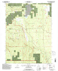
1995 Map of Swain Mountain
USGS Topo · Published 1997About this map
The Swain Mountain Experimental Forest and Lassen Experimental Forest dominate this landscape, showcasing the United States Forest Service's long-term management of high-elevation timber and watershed resources. Situated on the boundary of Lassen and Plumas counties, the terrain is characterized by volcanic peaks and high flats, including Swain Mountain and Jennie Mountain. This topography dictates the movement of water through systems like Robbers Creek and the Susan River, which flows past Silver Lake.
Find a feature on this map
29 named features on this map. Tap any name to fly to it.
Don’t see what you’re looking for? This feature index may not catch every label — zoom into the map to look around manually.
Map Details
Editions of this 1995 Swain Mountain Map
This is the sole edition of this map. No revisions or reprints were ever made.
Other maps of this area

1886 · Honey Lake
USGS Topo · 1:250,000

1886 · Lassen Peak
USGS Topo · 1:250,000

1891 · Honey Lake
USGS Topo · 1:250,000

1892 · Lassen Peak
USGS Topo · 1:250,000

1893 · Honey Lake
USGS Topo · 1:250,000

1894 · Lassen Peak
USGS Topo · 1:250,000

1939 · Halls Flat
USGS Topo · 1:125,000

1955 · Westwood
USGS Topo · 1:62,500

1955 · Westwood
USGS Topo · 1:250,000

1956 · Chester
USGS Topo · 1:62,500