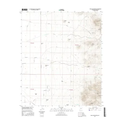
2017 Map of Swallow Fork Peak
USGS Topo · Published 2017About this map
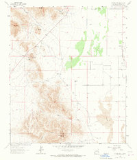
Cotton City sits in the southwestern corner of this desert landscape, surrounded by a network of ranch roads and specialized drainage features essential for water management in Hidalgo County. The topography is defined by the sharp rise of the Pyramid Mountains to the east, where heights such as Swallow Fork Peak, Mexican Hat, and Lightning Dock Mtn overlook the Animas Valley floor. A complex system of ephemeral watercourses including Mansfield Wash, Hampton Draw, and Goat Canyon cuts through the terrain, directed toward man-made collection points like C C C Tank and Goat Camp Tank. This 2017 survey reflects the persistent ranching and agricultural character of the region, evidenced by roads like San Pedro Ranch Rd and Rouse Ranch Rd, which connect the isolated peaks and canyons to the small settlement of Cotton City.
Find a feature on this map
44 named features on this map. Tap any name to fly to it.
Don’t see what you’re looking for? This feature index may not catch every label — zoom into the map to look around manually.
Map Details
Editions of this 2017 Swallow Fork Peak Map
This is the sole edition of this map. No revisions or reprints were ever made.
Other maps of this area

1954 · Silver City
USGS Topo · 1:250,000

1958 · Silver City
USGS Topo · 1:250,000

1962 · Silver City
USGS Topo · 1:250,000

1963 · Lordsburg
USGS Topo · 1:24,000
1964 · South Pyramid Peak
USGS Topo · 1:24,000

1964 · Pyramid Peak
USGS Topo · 1:24,000
1964 · Table Top Mountain
USGS Topo · 1:24,000
1964 · Mondel
USGS Topo · 1:24,000

1964 · Gary
USGS Topo · 1:24,000
1964 · Cotton City
USGS Topo · 1:24,000