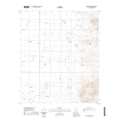
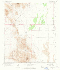
2023 Map of Swallow Fork Peak
USGS Topo · Published 2023About this map
Cotton City sits as the primary settlement within this high-desert landscape of Hidalgo County, where ranching roads and desert washes define the terrain. The eastern edge of the quadrangle is dominated by the steep rises of the Pyramid Mountains, including prominent landmarks like Swallow Fork Peak and the distinctive Mexican Hat formation. This 2023 survey illustrates a modern water management system in an arid environment, characterized by numerous stock tanks such as Wheelbarrow Tank, C C C Tank, and Goat Camp Tank.
Find a feature on this map
43 named features on this map. Tap any name to fly to it.
Don’t see what you’re looking for? This feature index may not catch every label — zoom into the map to look around manually.
Map Details
Editions of this 2023 Swallow Fork Peak Map
This is the sole edition of this map. No revisions or reprints were ever made.
Other maps of this area

1954 · Silver City
USGS Topo · 1:250,000

1958 · Silver City
USGS Topo · 1:250,000

1962 · Silver City
USGS Topo · 1:250,000

1963 · Lordsburg
USGS Topo · 1:24,000
1964 · South Pyramid Peak
USGS Topo · 1:24,000

1964 · Pyramid Peak
USGS Topo · 1:24,000
1964 · Table Top Mountain
USGS Topo · 1:24,000
1964 · Mondel
USGS Topo · 1:24,000

1964 · Gary
USGS Topo · 1:24,000
1964 · Cotton City
USGS Topo · 1:24,000