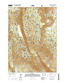
2014 Map of Swan Lake Point
USGS Topo · Published 2014About this map
Swan Lake Point rises prominently above the surrounding high desert terrain in this Klamath County landscape within the Winema National Forest. The geography is defined by significant volcanic and tectonic features, including the expansive Ya Whee Plateau and the Ya Whee Plateau Rim that drops toward the lowlands. The presence of numerous water sources such as Wrights Spring, Algoma Spring, and Bear Wallows Spring indicates the critical role of specific water points in this arid environment for both wildlife and forestry management. A network of Forest Service roads, including Nat For Dev Rd 5813 and Nat For Dev Rd 9718, provides access to high-elevation points like Edgewood Mtn and Saddle Mtn. The map also captures infrastructure at the Relay Site, showing the modern utility of these high ridges.
Find a feature on this map
27 named features on this map. Tap any name to fly to it.
Don’t see what you’re looking for? This feature index may not catch every label — zoom into the map to look around manually.
Map Details
Editions of this 2014 Swan Lake Point Map
This is the sole edition of this map. No revisions or reprints were ever made.
Other maps of this area

1889 · Klamath
USGS Topo · 1:250,000

1894 · Klamath
USGS Topo · 1:250,000

1955 · Klamath Falls
USGS Topo · 1:250,000

1956 · Calimus Butte
USGS Topo · 1:62,500

1957 · Chiloquin
USGS Topo · 1:62,500

1957 · Swan Lake
USGS Topo · 1:62,500

1957 · Modoc Point
USGS Topo · 1:62,500

1958 · Klamath Falls
USGS Topo · 1:250,000

1980 · Williamson River
USGS Topo · 1:100,000
1985 · Modoc Point
USGS Topo · 1:24,000