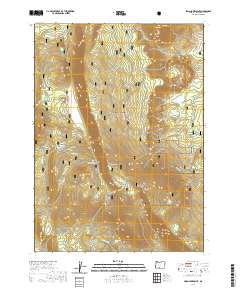
2020 Map of Swan Lake Point
USGS Topo · Published 2020About this map
Winema National Forest encompasses this high-elevation landscape in Klamath County, characterized by a series of prominent volcanic peaks and expansive mountain meadows. The terrain is anchored by the massive Swan Lake Mtn and the nearby Swan Lake Point, which rises above the deep seasonal snowpacks of Swan Lake Point (Snow). To the north, the Ya Whee Plateau and its corresponding Ya Whee Plateau Rim overlook Choptie Prairie and the lower-lying Four-bit Flat. Reliable water sources such as Algoma Spring, Bear Wallows Spring, and Edgewood Spring are scattered across the slopes, supporting the timber and grazing lands of the region. This 2020 data captures the network of forest roads and switchbacks necessary to navigate the steep ascents between Edgewood Mtn and Saddle Mtn.
Find a feature on this map
44 named features on this map. Tap any name to fly to it.
Don’t see what you’re looking for? This feature index may not catch every label — zoom into the map to look around manually.
Map Details
Editions of this 2020 Swan Lake Point Map
This is the sole edition of this map. No revisions or reprints were ever made.
Other maps of this area

1889 · Klamath
USGS Topo · 1:250,000

1894 · Klamath
USGS Topo · 1:250,000

1955 · Klamath Falls
USGS Topo · 1:250,000

1956 · Calimus Butte
USGS Topo · 1:62,500

1957 · Chiloquin
USGS Topo · 1:62,500

1957 · Swan Lake
USGS Topo · 1:62,500

1957 · Modoc Point
USGS Topo · 1:62,500

1958 · Klamath Falls
USGS Topo · 1:250,000

1980 · Williamson River
USGS Topo · 1:100,000
1985 · Modoc Point
USGS Topo · 1:24,000