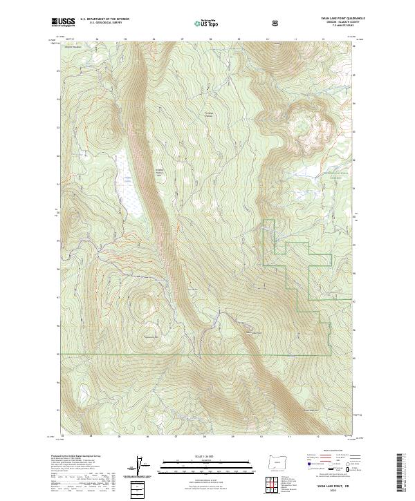
2023 Map of Swan Lake Point
USGS Topo · Published 2023About this map
Swan Lake Mtn and the prominent Swan Lake Point define the high-elevation terrain of this Klamath County landscape, which transitions from the steep Ya Whee Plateau Rim down toward the seasonal wetlands of Choptie Prairie. Much of the eastern portion of the sheet is protected within the Winema National Forest, showing a network of forest service roads and trails that traverse the ridges between Edgewood Mtn and Saddle Mtn. The hydrology of this volcanic upland is marked by numerous isolated water sources, including Wrights Spring, Algoma Spring, and the Bear Wallows Spring. These springs and meadows like Wrights Meadows suggest a long history of seasonal land use for grazing or timber, as water remains the primary driver of movement through the high desert forest.
Find a feature on this map
40 named features on this map. Tap any name to fly to it.
Don’t see what you’re looking for? This feature index may not catch every label — zoom into the map to look around manually.
Map Details
Editions of this 2023 Swan Lake Point Map
This is the sole edition of this map. No revisions or reprints were ever made.
Other maps of this area

1889 · Klamath
USGS Topo · 1:250,000

1894 · Klamath
USGS Topo · 1:250,000

1955 · Klamath Falls
USGS Topo · 1:250,000

1956 · Calimus Butte
USGS Topo · 1:62,500

1957 · Chiloquin
USGS Topo · 1:62,500

1957 · Swan Lake
USGS Topo · 1:62,500

1957 · Modoc Point
USGS Topo · 1:62,500

1958 · Klamath Falls
USGS Topo · 1:250,000

1980 · Williamson River
USGS Topo · 1:100,000
1985 · Modoc Point
USGS Topo · 1:24,000