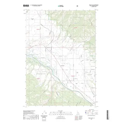
2023 Map of Swan Valley
USGS Topo · Published 2023About this map
The Snake River carves through this corner of Bonneville County, defining the corridor where the settlements of Swan Valley and Irwin are situated. This modern survey reflects a landscape where public lands of the Targhee National Forest and Caribou National Forest meet the agricultural and residential life of the river bottom. The map traces the transition from the irrigated fields of Flatiron to the high elevations of the Caribou Range and Ross Peak. Local aviation is represented by Huskey Airport, while genealogy interests are served by the location of the Swan Valley Cem and the Burton-Irwin Cem. The intricate network of canyons, such as Oakden Canyon and Rainey Creek, illustrates the complex drainage system feeding into the main river valley, a topography that has long dictated the placement of roads like Pine Creek Rd and Ranger Station Rd.
Find a feature on this map
81 named features on this map. Tap any name to fly to it.
Don’t see what you’re looking for? This feature index may not catch every label — zoom into the map to look around manually.
Map Details
Editions of this 2023 Swan Valley Map
This is the sole edition of this map. No revisions or reprints were ever made.
Other maps of this area

1932 · Irwin
USGS Topo · 1:96,000

1935 · Irwin
USGS Topo · 1:125,000

1943 · Driggs
USGS Topo · 1:62,500

1943 · Garns Mtn
USGS Topo · 1:62,500

1946 · Driggs
USGS Topo · 1:62,500

1946 · Garns Mtn
USGS Topo · 1:62,500

1955 · Driggs
USGS Topo · 1:250,000

1958 · Driggs
USGS Topo · 1:250,000

1962 · Driggs
USGS Topo · 1:250,000

1966 · Conant Valley
USGS Topo · 1:24,000