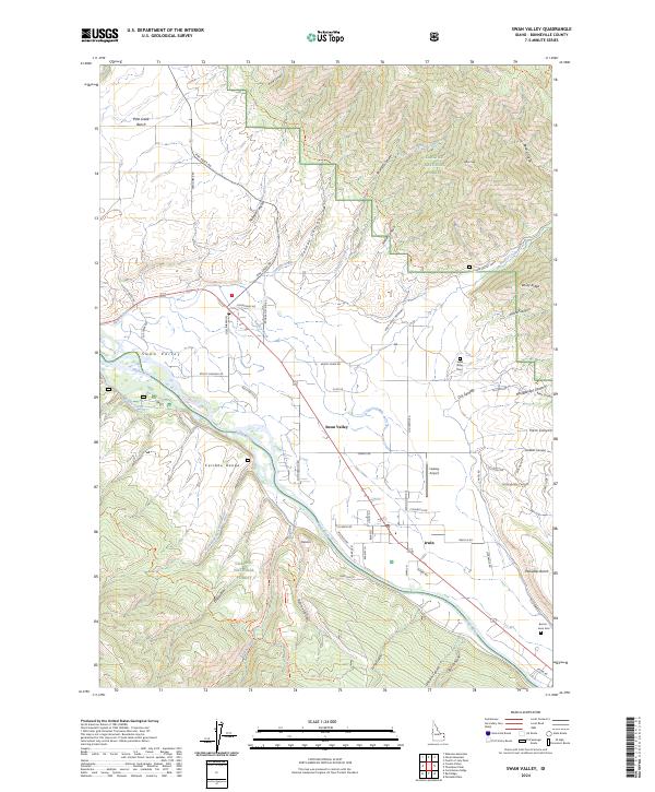
2024 Map of Swan Valley
USGS Topo · Published 2024About this map
Swan Valley and Irwin serve as the primary residential hubs in this canyon-ribboned landscape, situated along the corridor of the Snake River. The terrain is defined by the sharp transition from the river valley to the surrounding peaks of the Caribou Range and the Targhee National Forest. Local infrastructure is anchored by small aviation and community landmarks, including the Huskey Airport and the Swan Valley Cem, while the road network follows the natural contours of the land through passages like Oakden Canyon and Rainey Creek Rd. Historically significant landforms like Pine Creek Bench and Palisades Bench illustrate the geological benching typical of this region. Native heritage and mountain accessibility are visible through marked routes such as the Echo/Indian Creek Trl and the Paawahan to 'i-Naakwaide trail.
Find a feature on this map
79 named features on this map. Tap any name to fly to it.
Don’t see what you’re looking for? This feature index may not catch every label — zoom into the map to look around manually.
Map Details
Editions of this 2024 Swan Valley Map
This is the sole edition of this map. No revisions or reprints were ever made.
Other maps of this area

1932 · Irwin
USGS Topo · 1:96,000

1935 · Irwin
USGS Topo · 1:125,000

1943 · Driggs
USGS Topo · 1:62,500

1943 · Garns Mtn
USGS Topo · 1:62,500

1946 · Driggs
USGS Topo · 1:62,500

1946 · Garns Mtn
USGS Topo · 1:62,500

1955 · Driggs
USGS Topo · 1:250,000

1958 · Driggs
USGS Topo · 1:250,000

1962 · Driggs
USGS Topo · 1:250,000

1966 · Conant Valley
USGS Topo · 1:24,000