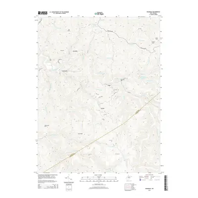
2014 Map of Swandale
USGS Topo · Published 2014About this map
Swandale sits along the Buffalo Creek corridor in this 2014 representation of the mountainous boundary between Clay and Nicholas Counties. The landscape is defined by its industrial and burial history, particularly evident in the presence of the Taylor Fork Refuse Disposal Lake and several small family or community burial grounds like Ramsey Cem and Acree Cem. Settlement patterns follow the winding creek beds and narrow ridges, with small clusters at Cressmont, Eakle, and Enoch. High points such as Big Knob and Wallowhole Knob provide significant vertical relief, while the Pond Ridge Lookout Tower remains a notable landmark on the eastern ridge. This survey documents the modern road network, including the Dundon Widen Rd and numerous county routes, alongside the complex drainage system of the Hickory Fork and Lilly Fork.
Find a feature on this map
68 named features on this map. Tap any name to fly to it.
Don’t see what you’re looking for? This feature index may not catch every label — zoom into the map to look around manually.
Map Details
Editions of this 2014 Swandale Map
This is the sole edition of this map. No revisions or reprints were ever made.
Other maps of this area

1889 · Nicholas
USGS Topo · 1:125,000

1891 · Nicholas
USGS Topo · 1:125,000

1893 · Sutton
USGS Topo · 1:125,000

1897 · Kanawha Falls
USGS Topo · 1:125,000

1900 · Kanawha Falls
USGS Topo · 1:125,000

1901 · Nicholas
USGS Topo · 1:125,000

1901 · Kanawha Falls
USGS Topo · 1:125,000

1906 · Otter
USGS Topo · 1:62,500

1907 · Otter
USGS Topo · 1:62,500

1908 · Clay
USGS Topo · 1:48,000