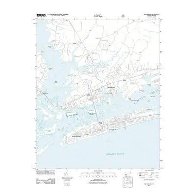
2011 Map of Swansboro
USGS Topo · Published 2011About this map
Bogue Sound serves as the central focal point of this coastal survey, separating the mainland settlements of Swansboro, Cedar Point, and Cape Carteret from the barrier island developments of Emerald Isle. The map captures the complex shoreline of the White Oak River as it meets Onslow Bay, showing a landscape defined by saltwater estuaries, tidal marshes, and numerous small islands such as Jones Island and Huggins Island. Inland, the Peletier Fire Tower stands near Peletier, marking the edge of the coastal forests.
Find a feature on this map
166 named features on this map. Tap any name to fly to it.
Don’t see what you’re looking for? This feature index may not catch every label — zoom into the map to look around manually.
Map Details
Editions of this 2011 Swansboro Map
This is the sole edition of this map. No revisions or reprints were ever made.
Other maps of this area

1942 · Maysville
USGS Topo · 1:62,500

1942 · Swansboro
USGS Topo · 1:62,500

1948 · Maysville
USGS Topo · 1:62,500

1948 · Swansboro
USGS Topo · 1:62,500

1949 · Salter Path
USGS Topo · 1:24,000

1949 · Masontown
USGS Topo · 1:24,000

1951 · Salter Path
USGS Topo · 1:24,000

1951 · Masontown
USGS Topo · 1:24,000

1952 · Hubert
USGS Topo · 1:24,000

1952 · Swansboro
USGS Topo · 1:24,000