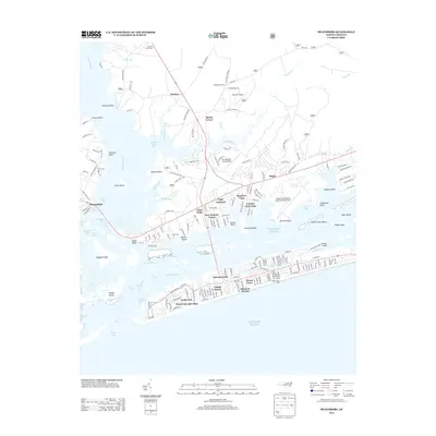
2013 Map of Swansboro
USGS Topo · Published 2013About this map
Peletier Fire Tower stands as a vertical landmark overlooking the coastal wetlands and sound-side communities of North Carolina's Crystal Coast. The 2013 landscape is characterized by a complex network of barrier islands and tidal channels, where the White Oak River meets the Atlantic Ocean via Bogue Inlet. This era shows significant residential development concentrated along the barrier strand, with named subdivisions like Pebble Beach, Ocean Crest, and Point Emerald Villas lining the oceanfront.
Find a feature on this map
99 named features on this map. Tap any name to fly to it.
Don’t see what you’re looking for? This feature index may not catch every label — zoom into the map to look around manually.
Map Details
Editions of this 2013 Swansboro Map
This is the sole edition of this map. No revisions or reprints were ever made.
Other maps of this area

1942 · Maysville
USGS Topo · 1:62,500

1942 · Swansboro
USGS Topo · 1:62,500

1948 · Maysville
USGS Topo · 1:62,500

1948 · Swansboro
USGS Topo · 1:62,500

1949 · Salter Path
USGS Topo · 1:24,000

1949 · Masontown
USGS Topo · 1:24,000

1951 · Salter Path
USGS Topo · 1:24,000

1951 · Masontown
USGS Topo · 1:24,000

1952 · Hubert
USGS Topo · 1:24,000

1952 · Swansboro
USGS Topo · 1:24,000