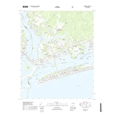
2019 Map of Swansboro
USGS Topo · Published 2019About this map
The coastal waters and barrier islands of the Outer Banks define this coastal landscape, where the White Oak River meets Bogue Sound. This survey captures the intricate network of tidal channels and marshes, including Main Channel, Burden Channel, and Bank Channel, which navigate the space between the mainland and the seaward expanse of Emerald Isle. The residential development along the shoreline is contrasted by the protected acreage of the Croatan National Forest and the aviation infrastructure at Triple M Airport and the Bogue Field Marine Corps Auxiliary Field.
Find a feature on this map
184 named features on this map. Tap any name to fly to it.
Don’t see what you’re looking for? This feature index may not catch every label — zoom into the map to look around manually.
Map Details
Editions of this 2019 Swansboro Map
This is the sole edition of this map. No revisions or reprints were ever made.
Other maps of this area

1942 · Maysville
USGS Topo · 1:62,500

1942 · Swansboro
USGS Topo · 1:62,500

1948 · Maysville
USGS Topo · 1:62,500

1948 · Swansboro
USGS Topo · 1:62,500

1949 · Salter Path
USGS Topo · 1:24,000

1949 · Masontown
USGS Topo · 1:24,000

1951 · Salter Path
USGS Topo · 1:24,000

1951 · Masontown
USGS Topo · 1:24,000

1952 · Hubert
USGS Topo · 1:24,000

1952 · Swansboro
USGS Topo · 1:24,000