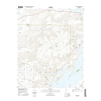
2014 Map of Swearengin
USGS Topo · Published 2014About this map
Guntersville Lake and the Tennessee River dominate the southeastern landscape of this Jackson and Marshall County region. The terrain is defined by a series of significant elevations and depressions, such as Gunters Mtn, Pisgah Mtn, and Cave Mtn, alongside numerous hollows and coves like Stillhouse Hollow and Saltpeter Cove. The settlement pattern is largely rural, with clusters of activity at Swearengin, Grant, and Oak Grove.
Find a feature on this map
152 named features on this map. Tap any name to fly to it.
Don’t see what you’re looking for? This feature index may not catch every label — zoom into the map to look around manually.
Map Details
Editions of this 2014 Swearengin Map
This is the sole edition of this map. No revisions or reprints were ever made.
Other maps of this area

1885 · Gadsden
USGS Topo · 1:125,000

1888 · Gadsden
USGS Topo · 1:125,000

1888 · Scottsboro
USGS Topo · 1:125,000

1892 · Scottsboro
USGS Topo · 1:125,000

1892 · Gadsden
USGS Topo · 1:125,000

1895 · Gadsden
USGS Topo · 1:125,000

1903 · Gadsden
USGS Topo · 1:125,000

1936 · Scottsboro
USGS Topo · 1:24,000

1936 · Columbus City
USGS Topo · 1:24,000

1936 · Langston
USGS Topo · 1:24,000