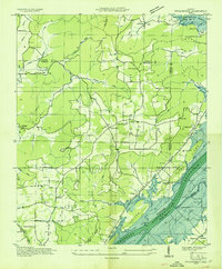
1936 Map of Swearengin
USGS Topo · Published 1936About this map
The Tennessee Valley Authority and U.S. Geological Survey documented this rugged stretch of Northeast Alabama as the landscape prepared for significant change. The Tennessee River dominates the southeastern quadrant, where the shoreline is marked as "Proposed," indicating the impoundment that would soon reshape the valley. Above the river plain, Gunter Mountain and the Burns Reservation define the local topography, with numerous coves like Kennamer Cove and Thomas Cove providing the primary sites for small farming settlements. Community life is well-documented through scattered landmarks such as the Old Barclay Mill, the State Prison Camp C, and several rural meeting houses including Beulah Ch and Welcome Home Ch. The map captures a pre-flood economy of river landings like Romans Landing and upland hamlets like Swearengin, offering a precise record of family-named features before the full impact of the Guntersville Dam project.
Find a feature on this map
65 named features on this map. Tap any name to fly to it.
Don’t see what you’re looking for? This feature index may not catch every label — zoom into the map to look around manually.
Map Details
Editions of this 1936 Swearengin Map
This is the sole edition of this map. No revisions or reprints were ever made.
Other maps of this area

1885 · Gadsden
USGS Topo · 1:125,000

1888 · Gadsden
USGS Topo · 1:125,000

1888 · Scottsboro
USGS Topo · 1:125,000

1892 · Scottsboro
USGS Topo · 1:125,000

1892 · Gadsden
USGS Topo · 1:125,000

1895 · Gadsden
USGS Topo · 1:125,000

1903 · Gadsden
USGS Topo · 1:125,000

1936 · Scottsboro
USGS Topo · 1:24,000

1936 · Columbus City
USGS Topo · 1:24,000

1936 · Langston
USGS Topo · 1:24,000