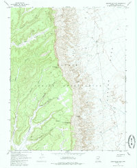
1968 Map of Sweathouse Peak
USGS Topo · Published 1985About this map
Carson Mesa and the surrounding high desert terrain within the Navajo Indian Reservation dominate this late-1960s survey. The landscape is defined by dramatic elevation changes, moving from the depths of Cottonwood Canyon and Wind Rock Valley up to prominent landmarks like Yale Point and Sweathouse Peak. For those studying the geography of this portion of Apache County, the map provides precise locations for vital water sources, including Sweetwater Spring, Cow Spring, and Nee Springs. Evidence of human activity in this remote area is documented through a Radio Tower, a single identified Mine, and a Prospect located near Red Willow Canyon. The topography is further detailed by a network of seasonal washes and steep-walled canyons, such as Tse Da Ahoodzo Canyon and Sagebrush Canyon, connected by a designated Pack Trail.
Find a feature on this map
23 named features on this map. Tap any name to fly to it.
Don’t see what you’re looking for? This feature index may not catch every label — zoom into the map to look around manually.
Map Details
Editions of this 1968 Sweathouse Peak Map
2 editions found
Other maps of this area

1892 · Canyon De Chelly
USGS Topo · 1:250,000

1954 · Shiprock
USGS Topo · 1:250,000

1958 · Shiprock
USGS Topo · 1:250,000

1959 · Shiprock
USGS Topo · 1:250,000

1968 · Tah Chee Wash
USGS Topo · 1:24,000

1968 · Many Farms SW
USGS Topo · 1:24,000

1968 · Windy Valley
USGS Topo · 1:24,000
1968 · Rough Rock
USGS Topo · 1:24,000
1968 · Rough Rock NW
USGS Topo · 1:24,000
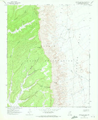
1968 · Sweathouse Peak
USGS Topo · 1:24,000