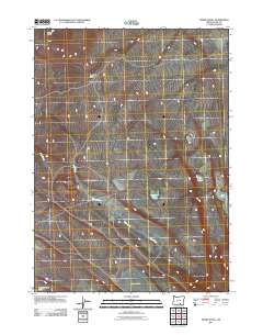
2011 Map of Swede Knoll
USGS Topo · Published 2011About this map
Desert Lake and Thunderbird Lake dominate the southern portion of this high desert landscape in Lake County, where seasonal water sources and intermittent drainages define the area's character. The drainage patterns are anchored by Deer Creek, which meanders across the central terrain, while Robinson Draw cuts through the northern elevations near Swede Knoll. This area of southern Oregon is characterized by its numerous small basins and playas, including Fitzgerald Lake, Twin Lakes, and Link Lake. These landforms suggest a reliance on ephemeral water management in an environment where natural depressions serve as primary landmarks. The scarcity of permanent settlements on this sheet highlights the isolation of this corner of the Great Basin during the early 21st century.
Find a feature on this map
8 named features on this map. Tap any name to fly to it.
Don’t see what you’re looking for? This feature index may not catch every label — zoom into the map to look around manually.
Map Details
Editions of this 2011 Swede Knoll Map
This is the sole edition of this map. No revisions or reprints were ever made.
Other maps of this area

1955 · Adel
USGS Topo · 1:250,000

1957 · Adel
USGS Topo · 1:250,000

1958 · Adel
USGS Topo · 1:250,000

1962 · Adel
USGS Topo · 1:250,000

1967 · Jacobs Reservoir
USGS Topo · 1:24,000

1967 · Campbell Lake
USGS Topo · 1:24,000

1967 · Flook Lake
USGS Topo · 1:24,000

1967 · Alger Lake
USGS Topo · 1:24,000

1967 · Warner Peak
USGS Topo · 1:24,000

1967 · Swede Knoll
USGS Topo · 1:24,000