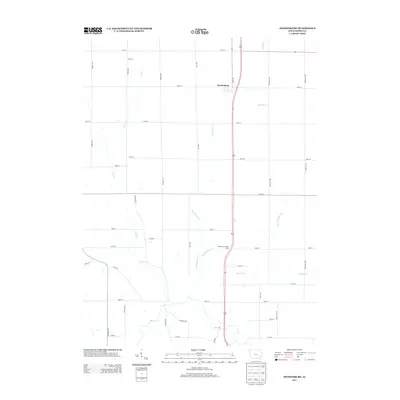
2013 Map of Swedesburg
USGS Topo · Published 2013About this map
Swedesburg serves as the primary focal point of this agricultural landscape in Henry County, situated within a dense grid of rural corridors like Iowa Ave and Lexington Ave. The terrain is defined by its sophisticated drainage network, where Big Cr meanders through the southern reaches, joined by several local tributaries including Brandywine Cr and Little Potomac Cr. This 2013 survey reflects the modern intersection of interstate transit and long-standing farmstead divisions, notably featuring the Hickory Grove Rest Area along the main north-south highway. The regular spacing of section roads such as 150th St and 180th St underscores the persistent influence of the Public Land Survey System on the Iowa prairie, even as small waterways like Lynn Cr and Spring Cr carve natural diversions through the geometric fields.
Find a feature on this map
33 named features on this map. Tap any name to fly to it.
Don’t see what you’re looking for? This feature index may not catch every label — zoom into the map to look around manually.
Map Details
Editions of this 2013 Swedesburg Map
This is the sole edition of this map. No revisions or reprints were ever made.
Other maps of this area

1958 · Burlington
USGS Topo · 1:250,000

1958 · Davenport
USGS Topo · 1:250,000

1961 · Burlington
USGS Topo · 1:250,000

1961 · Davenport
USGS Topo · 1:250,000

1962 · Davenport
USGS Topo · 1:250,000

1963 · Burlington
USGS Topo · 1:250,000

1980 · Trenton
USGS Topo · 1:24,000

1980 · Wayland
USGS Topo · 1:24,000

1980 · Lockridge East
USGS Topo · 1:24,000

1981 · Mount Pleasant
USGS Topo · 1:24,000