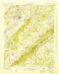
1942 Map of Sweetwater
USGS Topo · Published 1942About this map
The Sweetwater valley landscape of the early 1940s is defined by a dense network of rural institutions and the strategic corridor of the Southern railroad. The town center is anchored by the Tennessee Military Institute, while the surrounding countryside in Monroe and McMinn counties is dotted with community centers like Christianburg and the Fairview Tabernacle. Education and faith were clearly localized, evidenced by scattered landmarks such as High Point Sch, Gaines Sch, and Lee Ch.
Find a feature on this map
37 named features on this map. Tap any name to fly to it.
Don’t see what you’re looking for? This feature index may not catch every label — zoom into the map to look around manually.
Map Details
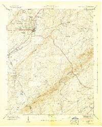
Editions of this 1942 Sweetwater Map
2 editions found
Other maps of this area

1886 · Cleveland
USGS Topo · 1:125,000

1887 · Kingston
USGS Topo · 1:125,000

1891 · Kingston
USGS Topo · 1:125,000

1892 · Cleveland
USGS Topo · 1:125,000

1893 · Murphy
USGS Topo · 1:125,000

1893 · Kingston
USGS Topo · 1:125,000

1895 · Cleveland
USGS Topo · 1:125,000

1895 · Loudon
USGS Topo · 1:125,000

1901 · Cleveland
USGS Topo · 1:125,000

1914 · Murphy
USGS Topo · 1:125,000