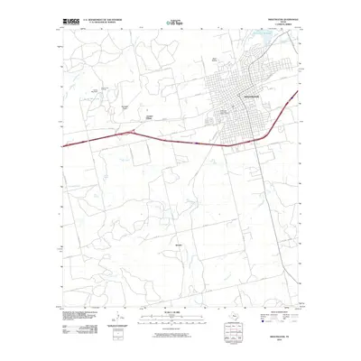
2010 Map of Sweetwater
USGS Topo · Published 2010About this map
Sweetwater serves as the focal point of this West Texas landscape, anchored by the Sweetwater Commercial Historic District and the historical aviation hub of Avenger Field. The terrain is defined by a series of drainages, including Sweetwater Creek, Idlewild Creek, and Finn Creek, which flow through the rolling plains and hollows like Wolf Hollow. To the west, the Rowan Hope Oil Field and Turner May Lake reflect the region's reliance on energy production and managed water resources. Smaller settlements and named locales such as Avenger Village and Shaufler are linked by a network of farm-to-market roads and the prominent Interstate 20 corridor. From the northern reaches near Country Club Lake to the springs of Inkman Spring and Oak Spring, the map illustrates a community balancing its deep aviation and ranching roots with modern industrial and energy infrastructure.
Find a feature on this map
57 named features on this map. Tap any name to fly to it.
Don’t see what you’re looking for? This feature index may not catch every label — zoom into the map to look around manually.
Map Details
Editions of this 2010 Sweetwater Map
This is the sole edition of this map. No revisions or reprints were ever made.
Other maps of this area

1893 · Roby
USGS Topo · 1:125,000

1893 · Sweetwater
USGS Topo · 1:125,000

1954 · Big Spring
USGS Topo · 1:250,000

1958 · Big Spring
USGS Topo · 1:250,000

1969 · Busby
USGS Topo · 1:24,000

1969 · Bench Mountain
USGS Topo · 1:24,000

1969 · Bernecker
USGS Topo · 1:24,000

1969 · Roscoe
USGS Topo · 1:24,000

1969 · Eskota
USGS Topo · 1:24,000

1969 · Sweetwater
USGS Topo · 1:24,000