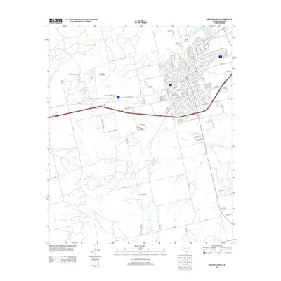
2012 Map of Sweetwater
USGS Topo · Published 2012About this map
The Sweetwater Commercial Historic District anchors this landscape, revealing a dense urban grid that transitions into the industrial and agricultural outskirts of Nolan County. Aviation history is prominent on the western edge at Avenger Field Airport, adjacent to the campus of Texas State Technical College-West Texas and the residential area of Avenger Village. These features point to the region's mid-century development as a hub for technical training and military aviation support.
Find a feature on this map
130 named features on this map. Tap any name to fly to it.
Don’t see what you’re looking for? This feature index may not catch every label — zoom into the map to look around manually.
Map Details
Editions of this 2012 Sweetwater Map
This is the sole edition of this map. No revisions or reprints were ever made.
Other maps of this area

1893 · Roby
USGS Topo · 1:125,000

1893 · Sweetwater
USGS Topo · 1:125,000

1954 · Big Spring
USGS Topo · 1:250,000

1958 · Big Spring
USGS Topo · 1:250,000

1969 · Busby
USGS Topo · 1:24,000

1969 · Bench Mountain
USGS Topo · 1:24,000

1969 · Bernecker
USGS Topo · 1:24,000

1969 · Roscoe
USGS Topo · 1:24,000

1969 · Eskota
USGS Topo · 1:24,000

1969 · Sweetwater
USGS Topo · 1:24,000