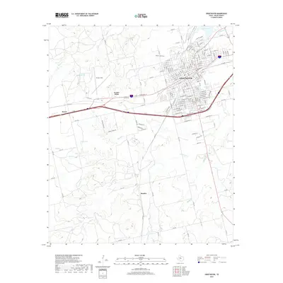
2019 Map of Sweetwater
USGS Topo · Published 2019About this map
Avenger Field serves as a prominent landmark west of Sweetwater, anchoring a landscape defined by its aviation history and ranching roots. This West Texas territory is carved by a network of seasonal drainages, including Sweetwater Cr, Finn Cr, and Seale Cr, which wind through the terrain toward Wolf Hollow. The settlement pattern follows the established corridors between Roscoe and the larger town of Sweetwater, with Avenger Village situated near the historic airfield. Local water sources like Inkman Spring, Oak Spring, and Bell Springs indicate the vital importance of groundwater in this semi-arid region. To the south, the smaller locality of Shaufler sits along the county road network, while Santa Fe Lake provides a notable point of interest on the northeastern edge of the city.
Find a feature on this map
178 named features on this map. Tap any name to fly to it.
Don’t see what you’re looking for? This feature index may not catch every label — zoom into the map to look around manually.
Map Details
Editions of this 2019 Sweetwater Map
This is the sole edition of this map. No revisions or reprints were ever made.
Other maps of this area

1893 · Roby
USGS Topo · 1:125,000

1893 · Sweetwater
USGS Topo · 1:125,000

1954 · Big Spring
USGS Topo · 1:250,000

1958 · Big Spring
USGS Topo · 1:250,000

1969 · Busby
USGS Topo · 1:24,000

1969 · Bench Mountain
USGS Topo · 1:24,000

1969 · Bernecker
USGS Topo · 1:24,000

1969 · Roscoe
USGS Topo · 1:24,000

1969 · Eskota
USGS Topo · 1:24,000

1969 · Sweetwater
USGS Topo · 1:24,000