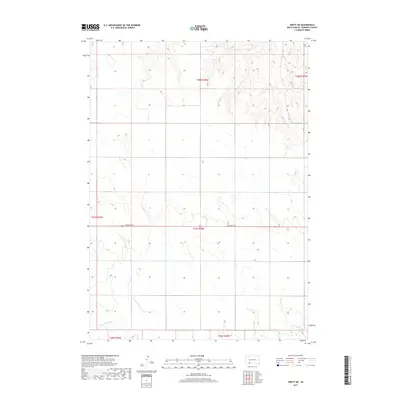
2017 Map of Swett NE
USGS Topo · Published 2017About this map
Little White River meanders across the southern reaches of this landscape in Bennett County, highlighting the drainage patterns of the high plains. The terrain is defined by a sparse network of section lines and the prominent east-west corridor of Bennett Ave, which serves as the primary artery through this rural expanse. This 2017 survey reflects the enduring grid of the Public Land Survey System, with boundaries such as t37n r38w and t38n r38w organizing the open range. The map provides a precise look at the topography north of Martin, where the land is carved by numerous draws and ridges that feed toward the river valley in the south.
Find a feature on this map
8 named features on this map. Tap any name to fly to it.
Don’t see what you’re looking for? This feature index may not catch every label — zoom into the map to look around manually.
Map Details
Editions of this 2017 Swett NE Map
This is the sole edition of this map. No revisions or reprints were ever made.
Other maps of this area

1955 · Martin
USGS Topo · 1:250,000

1958 · Martin
USGS Topo · 1:250,000

1981 · Patricia
USGS Topo · 1:25,000

1981 · Phantom Lake
USGS Topo · 1:25,000

1981 · Martin
USGS Topo · 1:25,000

1981 · Allen
USGS Topo · 1:25,000

1981 · Ecoffey Lake
USGS Topo · 1:25,000

1981 · Swett
USGS Topo · 1:25,000

1983 · Martin
USGS Topo · 1:100,000
2012 · Swett
USGS Topo · 1:24,000