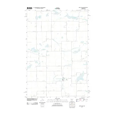
2010 Map of Swift Falls
USGS Topo · Published 2010About this map
The East Branch Chippewa River meanders through this portion of Swift County, anchoring the small settlement of Swift Falls. This community is centered around the Swift Falls Dam and the adjacent Swift Falls Reservoir, which provided the foundational water power and local resources for the area's development. Just to the east of the village, the Swift Falls Cemetery serves as a significant landmark for genealogists and those tracing local family histories in this rural landscape.
Find a feature on this map
48 named features on this map. Tap any name to fly to it.
Don’t see what you’re looking for? This feature index may not catch every label — zoom into the map to look around manually.
Map Details
Editions of this 2010 Swift Falls Map
This is the sole edition of this map. No revisions or reprints were ever made.
Other maps of this area

1953 · Saint Cloud
USGS Topo · 1:250,000

1957 · Saint Cloud
USGS Topo · 1:250,000

1958 · Saint Cloud
USGS Topo · 1:250,000

1968 · Starbuck
USGS Topo · 1:24,000

1968 · De Graff
USGS Topo · 1:24,000

1968 · Terrace
USGS Topo · 1:24,000

1968 · Lake Hassel
USGS Topo · 1:24,000

1968 · Benson
USGS Topo · 1:24,000

1968 · Lake Simon
USGS Topo · 1:24,000
1968 · Lake Minnewaska
USGS Topo · 1:24,000