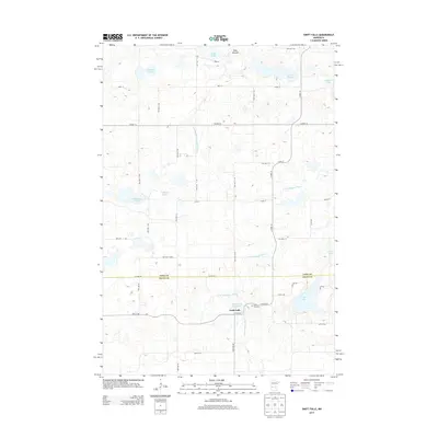
2013 Map of Swift Falls
USGS Topo · Published 2013About this map
The Swift Falls settlement serves as the primary focal point of this 2013 survey, positioned along the banks of the E Br Chippewa River. The landscape is characterized by a series of glacial depressions and ridges, most notably the Blue Mounds terrain in the north. The area's water network is extensive, featuring numerous bodies such as Kolstad Lake, Hoff Lake, and Gilchrist Lake. Downstream from the town, the Swift Falls Reservoir indicates the management of the river's flow for local use.
Find a feature on this map
45 named features on this map. Tap any name to fly to it.
Don’t see what you’re looking for? This feature index may not catch every label — zoom into the map to look around manually.
Map Details
Editions of this 2013 Swift Falls Map
This is the sole edition of this map. No revisions or reprints were ever made.
Other maps of this area

1953 · Saint Cloud
USGS Topo · 1:250,000

1957 · Saint Cloud
USGS Topo · 1:250,000

1958 · Saint Cloud
USGS Topo · 1:250,000

1968 · Starbuck
USGS Topo · 1:24,000

1968 · De Graff
USGS Topo · 1:24,000

1968 · Terrace
USGS Topo · 1:24,000

1968 · Lake Hassel
USGS Topo · 1:24,000

1968 · Benson
USGS Topo · 1:24,000

1968 · Lake Simon
USGS Topo · 1:24,000
1968 · Lake Minnewaska
USGS Topo · 1:24,000