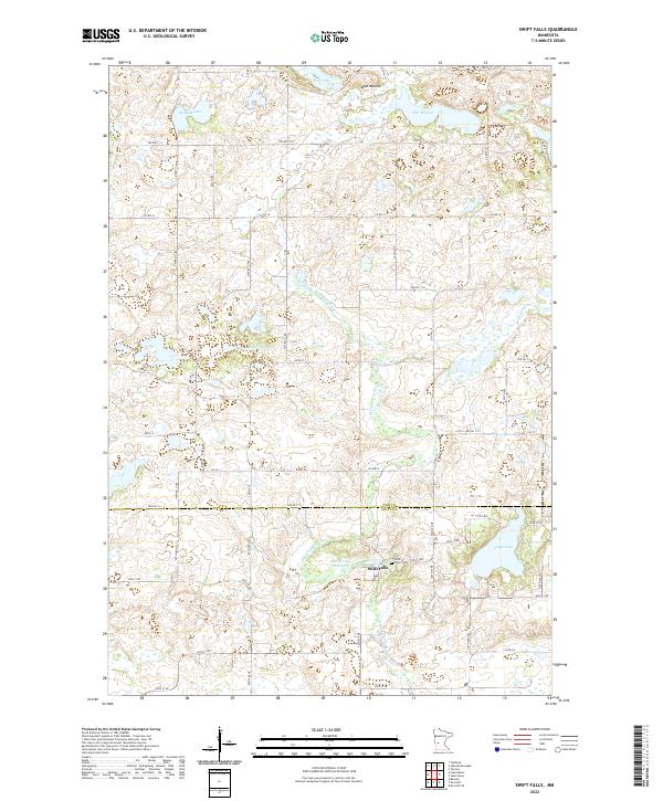
2022 Map of Swift Falls
USGS Topo · Published 2022About this map
Swift Falls centers this study of the prairie pothole region along the border of Pope and Swift Counties. The village is situated on the E Br Chippewa River, which feeds the Swift Falls Reservoir and provides the historical impetus for the early settlement. The surrounding landscape is defined by its glacial heritage, characterized by numerous small bodies of water such as Hoff Lake, Kolstad Lake, and Lake Hanson. To the north, the elevation rises toward Blue Mounds, a significant local landform. The map documents the rural infrastructure of the area, including the Swift Falls Cem and an extensive grid of township roads. The inclusion of County Ditch Number Fifteen reflects the region's managed water systems, essential for agricultural land use in this lake-dotted terrain.
Find a feature on this map
55 named features on this map. Tap any name to fly to it.
Don’t see what you’re looking for? This feature index may not catch every label — zoom into the map to look around manually.
Map Details
Editions of this 2022 Swift Falls Map
This is the sole edition of this map. No revisions or reprints were ever made.
Other maps of this area

1953 · Saint Cloud
USGS Topo · 1:250,000

1957 · Saint Cloud
USGS Topo · 1:250,000

1958 · Saint Cloud
USGS Topo · 1:250,000

1968 · Starbuck
USGS Topo · 1:24,000

1968 · De Graff
USGS Topo · 1:24,000

1968 · Terrace
USGS Topo · 1:24,000

1968 · Lake Hassel
USGS Topo · 1:24,000

1968 · Benson
USGS Topo · 1:24,000

1968 · Lake Simon
USGS Topo · 1:24,000
1968 · Lake Minnewaska
USGS Topo · 1:24,000