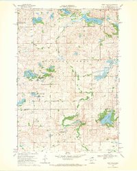
1968 Map of Swift Falls
USGS Topo · Published 1970About this map
Swift Falls sits along the East Branch Chippewa River, serving as a focal point for this rural landscape in the late 1960s. The area is defined by a dense network of glacial lakes and wetlands, including Camp Lake, Gilchrist Lake, and Hanson Lake, many of which are protected within numerous National Wildlife Management Areas. Evidence of the region's agricultural and social organization is visible through the placement of Townhall, School No 14, and School No 2241, alongside a local Cem in the Rolling Forks township.
Find a feature on this map
29 named features on this map. Tap any name to fly to it.
Don’t see what you’re looking for? This feature index may not catch every label — zoom into the map to look around manually.
Map Details
Editions of this 1968 Swift Falls Map
This is the sole edition of this map. No revisions or reprints were ever made.
Other maps of this area

1953 · Saint Cloud
USGS Topo · 1:250,000

1957 · Saint Cloud
USGS Topo · 1:250,000

1958 · Saint Cloud
USGS Topo · 1:250,000

1968 · Starbuck
USGS Topo · 1:24,000

1968 · De Graff
USGS Topo · 1:24,000

1968 · Terrace
USGS Topo · 1:24,000

1968 · Lake Hassel
USGS Topo · 1:24,000

1968 · Benson
USGS Topo · 1:24,000

1968 · Lake Simon
USGS Topo · 1:24,000
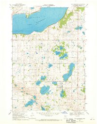
1968 · Lake Minnewaska
USGS Topo · 1:24,000