2022 Map of Swink
USGS Topo · Published 2022About this map
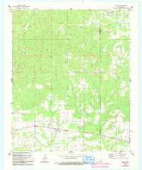
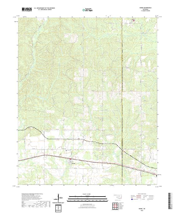
Swink serves as the primary settlement in this corner of southeastern Oklahoma, situated along a transportation corridor defined by Front St and South Rd. The landscape is characterized by a dense network of tributaries, including the namesake Doaksville Cr, which suggests a proximity to the historical regional center of Doaksville just beyond these bounds. To the north, the small community of Rufe sits near the headwaters of Pine Creek, while the eastern edge of the map is defined by the Choctaw Co McCurtain Co line. Local history is anchored by the Swink Cem and Valliant Cem, providing essential points of reference for genealogists. The presence of Tram Rd in the northwest quadrant points to the area's legacy of timber extraction or localized industrial transport that once moved through these creek-carved bottomlands.
Find a feature on this map
51 named features on this map. Tap any name to fly to it.
Don’t see what you’re looking for? This feature index may not catch every label — zoom into the map to look around manually.
Map Details
Editions of this 2022 Swink Map
This is the sole edition of this map. No revisions or reprints were ever made.
Historical Maps of Rufe Through Time
6 maps found