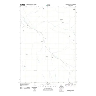
2010 Map of Swisher Mountain
USGS Topo · Published 2010About this map
Swisher Mountain and Sommer Camp Mountain dominate the high-elevation landscape of Owyhee County, defining a region where complex drainage patterns carve through the Idaho high desert. The area is characterized by deep basins and gulches, with Cow Creek and its many tributaries, including Soda Creek and Chimney Creek, creating a rugged network of watercourses. The presence of Cow Creek Rd provides a primary transit corridor through this terrain, winding past Jackson Gulch and Swisher Ridge.
Find a feature on this map
26 named features on this map. Tap any name to fly to it.
Don’t see what you’re looking for? This feature index may not catch every label — zoom into the map to look around manually.
Map Details
Editions of this 2010 Swisher Mountain Map
This is the sole edition of this map. No revisions or reprints were ever made.
Other maps of this area

1892 · Silver City
USGS Topo · 1:125,000

1894 · Silver City
USGS Topo · 1:125,000

1898 · Silver City
USGS Topo · 1:125,000

1955 · Jordan Valley
USGS Topo · 1:250,000

1955 · Boise
USGS Topo · 1:250,000

1957 · Jordan Valley
USGS Topo · 1:250,000

1958 · Boise
USGS Topo · 1:250,000

1958 · Jordan Valley
USGS Topo · 1:250,000

1962 · Boise
USGS Topo · 1:250,000

1965 · Rooster Comb Peak
USGS Topo · 1:62,500