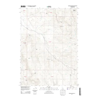
2013 Map of Swisher Mountain
USGS Topo · Published 2013About this map
Swisher Mtn and Sommer Camp Mtn dominate the high terrain of the Owyhee Mountains in this corner of southwestern Idaho. The landscape is defined by a complex network of drainages and springs, where water sources like Stanford Spring, Grace Spring, and Chubby Spring served as vital points for livestock and land management. The presence of named features like Petersons Crossing and Cow Creek Rd indicates the historical movement of people and goods through the canyons and across the flats. Topographical landmarks such as Spain Hill, Bare Hill, and the deep Split Rock Canyon reveal the erosion-carved character of the region. The high-elevation basins, including Sommercamp Basin and Baxter Basin, provide a clear look at the grazing and ranching heritage of the area, punctuated by numerous remote springs like Kiyi Spring and Willinicker Spring.
Find a feature on this map
53 named features on this map. Tap any name to fly to it.
Don’t see what you’re looking for? This feature index may not catch every label — zoom into the map to look around manually.
Map Details
Editions of this 2013 Swisher Mountain Map
This is the sole edition of this map. No revisions or reprints were ever made.
Other maps of this area

1892 · Silver City
USGS Topo · 1:125,000

1894 · Silver City
USGS Topo · 1:125,000

1898 · Silver City
USGS Topo · 1:125,000

1955 · Jordan Valley
USGS Topo · 1:250,000

1955 · Boise
USGS Topo · 1:250,000

1957 · Jordan Valley
USGS Topo · 1:250,000

1958 · Boise
USGS Topo · 1:250,000

1958 · Jordan Valley
USGS Topo · 1:250,000

1962 · Boise
USGS Topo · 1:250,000

1965 · Rooster Comb Peak
USGS Topo · 1:62,500