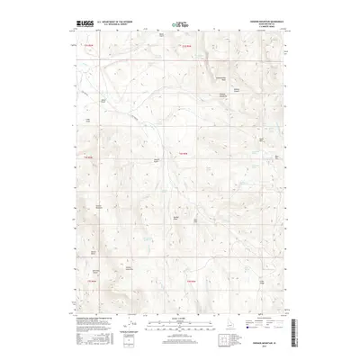
2017 Map of Swisher Mountain
USGS Topo · Published 2017About this map
The Owyhee Mountains define this high-altitude landscape, dominated by the prominent peaks of Swisher Mountain and Sommer Camp Mtn. This 2017 survey reveals a terrain defined by its complex hydrology, where numerous named water sources like Stanford Spring, Blue Clay Pit Spring, and Soda Spring provide critical points of interest in an otherwise arid environment. The presence of Chimney Pot Reservoir suggests managed water resources at the head of Chimney Cr.
Find a feature on this map
51 named features on this map. Tap any name to fly to it.
Don’t see what you’re looking for? This feature index may not catch every label — zoom into the map to look around manually.
Map Details
Editions of this 2017 Swisher Mountain Map
This is the sole edition of this map. No revisions or reprints were ever made.
Other maps of this area

1892 · Silver City
USGS Topo · 1:125,000

1894 · Silver City
USGS Topo · 1:125,000

1898 · Silver City
USGS Topo · 1:125,000

1955 · Jordan Valley
USGS Topo · 1:250,000

1955 · Boise
USGS Topo · 1:250,000

1957 · Jordan Valley
USGS Topo · 1:250,000

1958 · Boise
USGS Topo · 1:250,000

1958 · Jordan Valley
USGS Topo · 1:250,000

1962 · Boise
USGS Topo · 1:250,000

1965 · Rooster Comb Peak
USGS Topo · 1:62,500