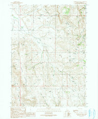
1990 Map of Swisher Mountain
USGS Topo · Published 1991About this map
Swisher Mountain and the high elevations of Swisher Ridge dominate this corner of Owyhee County, defined by a complex network of springs and seasonal drainages. The landscape is marked by resource exploration, indicated by numerous Prospect and Prospects notations concentrated in the east, alongside a Strip Mine located south of Soda Creek. Water management is central to the area's utility, with the Chimney Pot Reservoir situated in the western draws near Chimney Gulch.
Find a feature on this map
50 named features on this map. Tap any name to fly to it.
Don’t see what you’re looking for? This feature index may not catch every label — zoom into the map to look around manually.
Map Details
Editions of this 1990 Swisher Mountain Map
This is the sole edition of this map. No revisions or reprints were ever made.
Other maps of this area

1892 · Silver City
USGS Topo · 1:125,000

1894 · Silver City
USGS Topo · 1:125,000

1898 · Silver City
USGS Topo · 1:125,000

1955 · Jordan Valley
USGS Topo · 1:250,000

1955 · Boise
USGS Topo · 1:250,000

1957 · Jordan Valley
USGS Topo · 1:250,000

1958 · Boise
USGS Topo · 1:250,000

1958 · Jordan Valley
USGS Topo · 1:250,000

1962 · Boise
USGS Topo · 1:250,000

1965 · Rooster Comb Peak
USGS Topo · 1:62,500