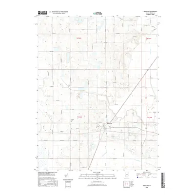
2016 Map of Switz City
USGS Topo · Published 2016About this map
Switz City serves as the central hub of this Indiana landscape, where a grid of rural routes meets the converging lines of regional infrastructure. The town's layout is defined by streets like Chestnut St and Fletcher St, while the surrounding Greene County countryside is characterized by an extensive system of agricultural drainage and natural waterways. Key water features such as Beehunter Ditch, Fourmile Ditch, and Sloan Ditch illustrate the long-term management of the low-lying terrain, working alongside Lattas Creek and Buck Cr. For those tracing local heritage, several burial grounds are preserved across the sections, including Switz City Cem, Buzan Cem, and Waggoner Cem. The map reflects a meticulously partitioned landscape of the mid-2010s, where traditional section lines are traced by an exhaustive network of county roads from Co Rd 700 N in the north to Co Rd 100 S in the south.
Find a feature on this map
47 named features on this map. Tap any name to fly to it.
Don’t see what you’re looking for? This feature index may not catch every label — zoom into the map to look around manually.
Map Details
Editions of this 2016 Switz City Map
This is the sole edition of this map. No revisions or reprints were ever made.
Other maps of this area

1908 · Bloomfield
USGS Topo · 1:62,500

1938 · Coal City
USGS Topo · 1:24,000

1938 · Switz City
USGS Topo · 1:24,000

1940 · Linton
USGS Topo · 1:24,000

1940 · Jasonville
USGS Topo · 1:24,000

1943 · Lyons
USGS Topo · 1:24,000

1943 · Sandborn
USGS Topo · 1:24,000

1947 · Switz City
USGS Topo · 1:24,000

1947 · Linton
USGS Topo · 1:24,000

1948 · Coal City
USGS Topo · 1:24,000