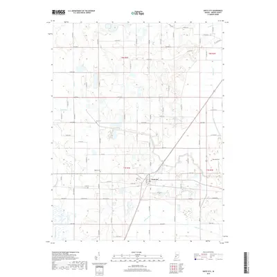
2019 Map of Switz City
USGS Topo · Published 2019About this map
Switz City serves as the central hub of this Indiana landscape, where local infrastructure and agricultural drainage networks define the terrain. The village is flanked by essential community markers, including the Switz City Cem and the nearby Waggoner Cem, providing significant touchpoints for genealogical research in Greene County. The surrounding countryside is heavily shaped by an extensive system of waterways and man-made channels like Beehunter Ditch, Fourmile Ditch, and Sloan Ditch, which manage the low-lying lands around Lattas Creek and Lemon Cr. To the east, Shawnee Field indicates a distinct area of land use amidst the grid of county roads. This 2019 survey documents the enduring layout of rural townships T7N and T8N, capturing the intersections of local history and modern land management.
Find a feature on this map
61 named features on this map. Tap any name to fly to it.
Don’t see what you’re looking for? This feature index may not catch every label — zoom into the map to look around manually.
Map Details
Editions of this 2019 Switz City Map
This is the sole edition of this map. No revisions or reprints were ever made.
Other maps of this area

1908 · Bloomfield
USGS Topo · 1:62,500

1938 · Coal City
USGS Topo · 1:24,000

1938 · Switz City
USGS Topo · 1:24,000

1940 · Linton
USGS Topo · 1:24,000

1940 · Jasonville
USGS Topo · 1:24,000

1943 · Lyons
USGS Topo · 1:24,000

1943 · Sandborn
USGS Topo · 1:24,000

1947 · Switz City
USGS Topo · 1:24,000

1947 · Linton
USGS Topo · 1:24,000

1948 · Coal City
USGS Topo · 1:24,000