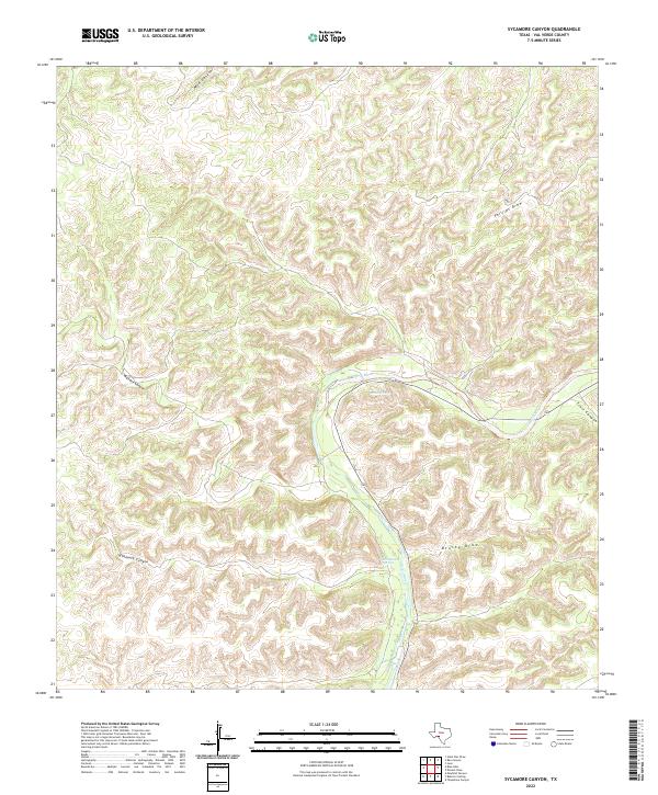
2022 Map of Sycamore Canyon
USGS Topo · Published 2022About this map
Devils River defines the lower-lying corridor of this landscape, cutting through a dense network of high ridges and narrow drainages in the Texas borderlands. This 2022 survey documents the hydrological significance of perennial water sources like Pecan Springs and Hudspeth Springs in an otherwise arid environment. These springs served as vital landmarks for early travel and ranching, providing reliable water where traditional draws and canyons often ran dry.
Find a feature on this map
9 named features on this map. Tap any name to fly to it.
Don’t see what you’re looking for? This feature index may not catch every label — zoom into the map to look around manually.
Map Details
Editions of this 2022 Sycamore Canyon Map
This is the sole edition of this map. No revisions or reprints were ever made.
Other maps of this area

1943 · Shumla
USGS Topo · 1:62,500

1944 · Baker Crossing
USGS Topo · 1:62,500

1954 · Sonora
USGS Topo · 1:250,000

1958 · Sonora
USGS Topo · 1:250,000

1958 · Del Rio
USGS Topo · 1:250,000

1964 · Del Rio
USGS Topo · 1:250,000

1970 · Juno
USGS Topo · 1:24,000

1970 · Steel Star Draw
USGS Topo · 1:24,000

1970 · Sycamore Canyon
USGS Topo · 1:24,000

1970 · Blue Hills
USGS Topo · 1:24,000