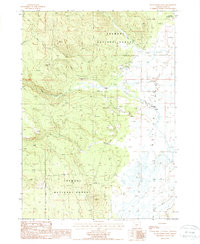
1988 Map of Sycan Marsh West
USGS Topo · Published 1988About this map
Sycan Marsh dominates the eastern portion of this high-altitude Oregon landscape, where the seasonal hydrology of the region is meticulously recorded. As shown in the late 1980s, the terrain transitions from the marshy lowlands of the Sycan River to the upland timber of the Fremont National Forest. Evidence of land use and human activity is scattered throughout, including several locations marked as Cinder Pit, likely supporting local road maintenance or forestry operations. The presence of the Camp Fifteen (Site) and the Carton Ranch provides specific points of interest for local historians studying early 20th-century logging and ranching heritage. Numerous water sources like Cold Spring, Coyote Creek, and Long Creek illustrate the drainage patterns critical to the surrounding watershed and the forest's ecosystem.
Find a feature on this map
13 named features on this map. Tap any name to fly to it.
Don’t see what you’re looking for? This feature index may not catch every label — zoom into the map to look around manually.
Map Details
Editions of this 1988 Sycan Marsh West Map
This is the sole edition of this map. No revisions or reprints were ever made.
Other maps of this area

1889 · Klamath
USGS Topo · 1:250,000

1894 · Klamath
USGS Topo · 1:250,000

1955 · Klamath Falls
USGS Topo · 1:250,000

1958 · Klamath Falls
USGS Topo · 1:250,000

1960 · Riverbed Butte
USGS Topo · 1:62,500

1960 · Sycan Marsh
USGS Topo · 1:62,500

1960 · Fuego Mountain
USGS Topo · 1:62,500

1960 · Yamsay Mountain
USGS Topo · 1:62,500

1980 · Williamson River
USGS Topo · 1:100,000
1988 · Riverbed Butte Spring
USGS Topo · 1:24,000