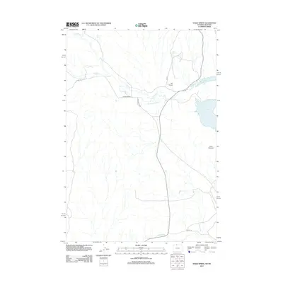
2012 Map of Sykes Spring
USGS Topo · Published 2012About this map
Sykes Mountain stands as a prominent landmark in this arid region on the Montana-Wyoming border, where water management defines the human footprint on the landscape. This 2012 survey illustrates the critical role of irrigation in Carbon County, featuring the Big Fork Canal and the Dew and Duffield Ditch which divert water through the dry terrain. The eastern edge of the map is dominated by the northern reaches of Bighorn Lake, a significant reservoir that contrasts with the seasonal drainage of Crooked Cr. Local geography is further marked by family or descriptive names for water sources, such as Sykes Spring and Britton Spring, which historically served as vital points in an area otherwise characterized by features like Big Coulee. The road network, including Gypsum Creek Rd and Crooked Creek Rd, follows the natural contours of the stream beds, reflecting a landscape where transport and survival are tied to the available water courses.
Find a feature on this map
14 named features on this map. Tap any name to fly to it.
Don’t see what you’re looking for? This feature index may not catch every label — zoom into the map to look around manually.
Map Details
Editions of this 2012 Sykes Spring Map
This is the sole edition of this map. No revisions or reprints were ever made.
Other maps of this area

1954 · Billings
USGS Topo · 1:250,000

1955 · Cody
USGS Topo · 1:250,000

1957 · Billings
USGS Topo · 1:250,000

1958 · Billings
USGS Topo · 1:250,000

1958 · Cody
USGS Topo · 1:250,000

1962 · Cody
USGS Topo · 1:250,000

1964 · Kane
USGS Topo · 1:24,000

1964 · Red Pryor Mountain
USGS Topo · 1:24,000

1964 · Lovell Lakes
USGS Topo · 1:24,000

1964 · Sykes Spring
USGS Topo · 1:24,000