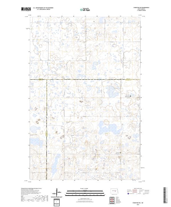
2024 Map of Sykeston SW
USGS Topo · Published 2024About this map
Stutsman County Waterfowl Production Area dominates this section of the Prairie Pothole Region, reflecting a landscape heavily defined by its glacial hydrology and conservation priorities. The terrain is a complex mosaic of wetlands and small water bodies that stretch across the intersection of Wells, Kidder, and Stutsman counties. This 2024 map documents the quiet rural character of the area, where historical markers of the community are found in its remote burial grounds. The New Home Seventh - Day Adventist Cem and the New Home Lutheran Cem stand as significant genealogical touchstones, positioned near Co Hwy 69 and a network of numbered section-line roads like 10th St SE. These sites provide a window into the settlement patterns of central North Dakota, where small denominational congregations established lasting roots amidst the sprawling grasslands and waterfowl habitats.
Find a feature on this map
29 named features on this map. Tap any name to fly to it.
Don’t see what you’re looking for? This feature index may not catch every label — zoom into the map to look around manually.
Map Details
Editions of this 2024 Sykeston SW Map
This is the sole edition of this map. No revisions or reprints were ever made.
Other maps of this area

1951 · Heaton
USGS Topo · 1:24,000

1951 · Dover
USGS Topo · 1:24,000

1951 · Sykeston
USGS Topo · 1:24,000

1952 · New Rockford
USGS Topo · 1:250,000

1956 · New Rockford
USGS Topo · 1:250,000

1971 · New Rockford
USGS Topo · 1:250,000

1972 · Woodworth
USGS Topo · 1:24,000

1972 · Lake Williams
USGS Topo · 1:24,000
1972 · Woodworth NW
USGS Topo · 1:24,000
1978 · Bowdon SE
USGS Topo · 1:24,000