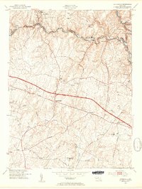
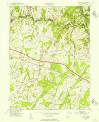
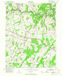
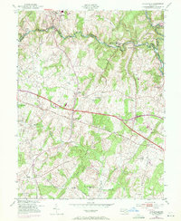
1953 Map of Sykesville
USGS Topo · Published 1954About this map
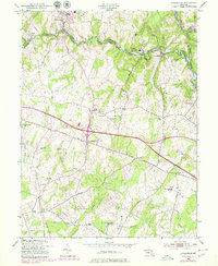
Sykesville and the winding course of the Patapsco River define this mid-century survey of the border between Carroll and Howard counties. The river valley is a hub of institutional and industrial infrastructure, dominated by the sprawling Henryton State Hospital and the tracks of the Baltimore and Ohio railroad. This transportation corridor contrasts with the rolling agricultural uplands to the south, where the historic National Pike bisects the landscape through West Friendship and Mayfield.
Find a feature on this map
37 named features on this map. Tap any name to fly to it.
Don’t see what you’re looking for? This feature index may not catch every label — zoom into the map to look around manually.
Map Details
Editions of this 1953 Sykesville Map
5 editions found
Other maps of this area

1892 · Laurel
USGS Topo · 1:62,500

1892 · Ellicott
USGS Topo · 1:62,500

1893 · Frederick
USGS Topo · 1:125,000

1894 · Ellicott
USGS Topo · 1:62,500

1894 · Laurel
USGS Topo · 1:62,500

1894 · Frederick
USGS Topo · 1:125,000

1897 · Laurel
USGS Topo · 1:62,500

1906 · Ellicott
USGS Topo · 1:62,500

1907 · Laurel
USGS Topo · 1:62,500

1908 · Patapsco
USGS Topo · 1:125,000