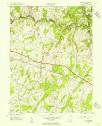
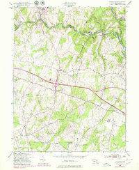
1953 Map of Sykesville
USGS Topo · Published 1954About this map
The South Branch Patapsco River forms a winding natural boundary between Carroll and Howard counties, anchoring a landscape of institutional campuses and small crossroads settlements in the mid-1950s. The northern reaches are dominated by the Henryton State Hospital and the extensive grounds of Patapsco State Park, while the Baltimore and Ohio railroad tracks trace the river's path through Sykesville and Marriottsville. Further south, the map reveals a rural transition toward more agricultural terrain, marked by the prominent Doughoregan Manor and the Franciscan Fathers Novitiate. This era shows the early development of the Sykesville Airfield and the enduring importance of the National Pike as a primary transit artery through West Friendship. The presence of numerous small houses of worship, such as Salem Ch and McKendree Ch, points to the scattered yet deeply rooted communities of the Patuxent valley.
Find a feature on this map
36 named features on this map. Tap any name to fly to it.
Don’t see what you’re looking for? This feature index may not catch every label — zoom into the map to look around manually.
Map Details
Editions of this 1953 Sykesville Map
5 editions found
Other maps of this area

1892 · Laurel
USGS Topo · 1:62,500

1892 · Ellicott
USGS Topo · 1:62,500

1893 · Frederick
USGS Topo · 1:125,000

1894 · Ellicott
USGS Topo · 1:62,500

1894 · Laurel
USGS Topo · 1:62,500

1894 · Frederick
USGS Topo · 1:125,000

1897 · Laurel
USGS Topo · 1:62,500

1906 · Ellicott
USGS Topo · 1:62,500

1907 · Laurel
USGS Topo · 1:62,500

1908 · Patapsco
USGS Topo · 1:125,000