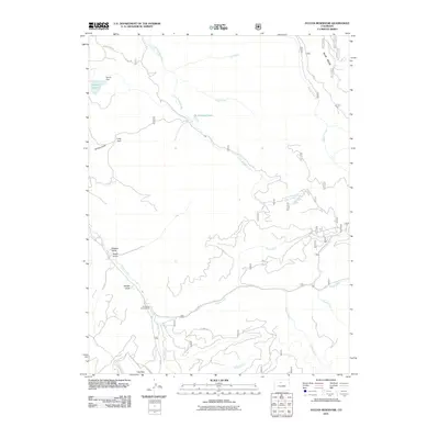
2011 Map of Sylvan Reservoir
USGS Topo · Published 2011About this map
Sylvan Reservoir and its associated Sylvan Dam anchor the northwest corner of this Grand County landscape, where the high-country drainage systems of the Rocky Mountains converge. The terrain is defined by a complex network of waterways, including the winding Little Muddy Creek and the Williams Fork, which are fed by numerous smaller streams like Kelly Creek and Boham Creek. Evidence of recreational land use is found at the Horseshoe Campground, situated near the junction of several county roads that provide access to the area's gulches and flats.
Find a feature on this map
32 named features on this map. Tap any name to fly to it.
Don’t see what you’re looking for? This feature index may not catch every label — zoom into the map to look around manually.
Map Details
Editions of this 2011 Sylvan Reservoir Map
This is the sole edition of this map. No revisions or reprints were ever made.
Other maps of this area

1915 · Longs Peak
USGS Topo · 1:125,000

1919 · Rocky Mountain National Park
USGS Topo · 1:125,000

1924 · Fraser
USGS Topo · 1:62,500

1926 · Fraser
USGS Topo · 1:62,500

1933 · Ute Peak
USGS Topo · 1:62,500

1937 · Ute Peak
USGS Topo · 1:62,500

1953 · Denver
USGS Topo · 1:250,000

1954 · Greeley
USGS Topo · 1:250,000

1954 · Craig
USGS Topo · 1:250,000

1957 · Denver
USGS Topo · 1:250,000