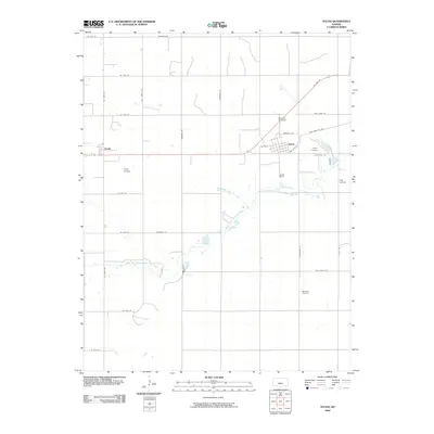
2009 Map of Sylvia
USGS Topo · Published 2009About this map
Sylvia and the smaller settlement of Zenith anchor this section of Reno County, where the agricultural grid is interrupted only by the meandering path of the North Fork Ninnescah River and its tributary, Zenithscah Creek. The landscape is defined by its long-established transport corridors, featuring both the modern US Hwy 50 and the traces of Old Hwy 50, alongside historically named routes like Trail West Rd. Local history and genealogy interests are well-represented by the Sylvia Cemetery and the more isolated Glendale Cemetery to the south. A notable concentration of private aviation is evident across the township, with Roberts Air Field, Hayes Airfield, and Hall Airfield marking the importance of small-scale flight in this rural Kansas prairie community at the start of the 21st century.
Find a feature on this map
33 named features on this map. Tap any name to fly to it.
Don’t see what you’re looking for? This feature index may not catch every label — zoom into the map to look around manually.
Map Details
Editions of this 2009 Sylvia Map
This is the sole edition of this map. No revisions or reprints were ever made.
Other maps of this area

1891 · Great Bend
USGS Topo · 1:125,000

1892 · Kingman
USGS Topo · 1:125,000

1892 · Pratt
USGS Topo · 1:125,000

1893 · Great Bend
USGS Topo · 1:125,000

1894 · Kingman
USGS Topo · 1:125,000

1894 · Pratt
USGS Topo · 1:125,000

1894 · Lyons
USGS Topo · 1:125,000

1955 · Great Bend
USGS Topo · 1:250,000

1955 · Pratt
USGS Topo · 1:250,000

1957 · Great Bend
USGS Topo · 1:250,000