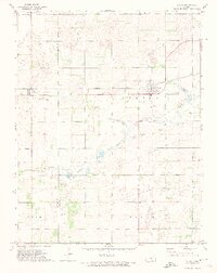
1971 Map of Sylvia
USGS Topo · Published 1974About this map
The town of Sylvia serves as a primary hub in this Reno County landscape, positioned along the Atchison Topeka and Santa Fe railroad line. This 1971 survey captures a rural Kansas economy balanced between agriculture, aviation, and energy extraction. The western edge of the quadrangle transitions into an Oil Field near the settlement of Zenith, while multiple private landing strips like Hayes Airfield and Hall Airfield dot the local farms. Water management and recreation are evident along the North Fork Ninnescah River, which feeds into Brownlee Lake and the Sunset Lakes area, the latter featuring a dedicated Fish Hatchery. For those researching local families, the map clearly identifies both the Sylvia Cem and the more remote Glendale Cem, providing specific spatial context for these community landmarks during the early 1970s.
Find a feature on this map
22 named features on this map. Tap any name to fly to it.
Don’t see what you’re looking for? This feature index may not catch every label — zoom into the map to look around manually.
Map Details
Editions of this 1971 Sylvia Map
This is the sole edition of this map. No revisions or reprints were ever made.
Other maps of this area

1891 · Great Bend
USGS Topo · 1:125,000

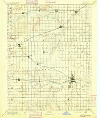
1892 · Kingman
USGS Topo · 1:125,000

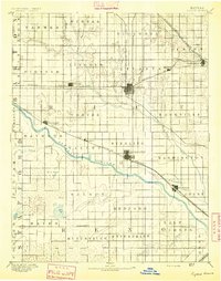
1892 · Pratt
USGS Topo · 1:125,000

1893 · Great Bend
USGS Topo · 1:125,000
1894 · Kingman
USGS Topo · 1:125,000

1894 · Pratt
USGS Topo · 1:125,000
1894 · Lyons
USGS Topo · 1:125,000

1955 · Great Bend
USGS Topo · 1:250,000

1955 · Pratt
USGS Topo · 1:250,000

1957 · Great Bend
USGS Topo · 1:250,000