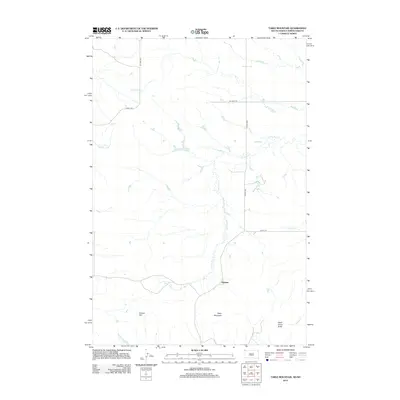
2012 Map of Table Mountain
USGS Topo · Published 2012About this map
Table Mountain and Dead Horse Butte anchor this high-plains landscape in Harding County, where the drainage network of Lone Tree Cr defines the local topography. This 2012 survey by the U.S. Geological Survey captures the isolated settlement of Karinen at the junction of several county routes, illustrating the sparse but vital transport infrastructure of northwest South Dakota. The land is marked by numerous named creek beds including Sevenmile Cr, Fivemile Cr, and Crooked Cr, which underscore the importance of water management and natural drainage in this arid environment. Elevation features like Cooper Hill rise above the surrounding terrain, providing landmarks for local navigation. The presence of Oil Well Rd points toward the regional energy industry, while the local road network consisting of Co Hwy-798 and Co Hwy-733 connects these remote points of interest.
Find a feature on this map
14 named features on this map. Tap any name to fly to it.
Don’t see what you’re looking for? This feature index may not catch every label — zoom into the map to look around manually.
Map Details
Editions of this 2012 Table Mountain Map
This is the sole edition of this map. No revisions or reprints were ever made.
Other maps of this area

1935 · Buffalo
USGS Topo · 1:125,000

1953 · Dickinson
USGS Topo · 1:250,000

1954 · Lemmon
USGS Topo · 1:250,000

1957 · Dickinson
USGS Topo · 1:250,000

1957 · Lemmon
USGS Topo · 1:250,000

1969 · Ladner NE
USGS Topo · 1:24,000

1969 · Table Mountain
USGS Topo · 1:24,000

1969 · Ladner
USGS Topo · 1:24,000

1969 · Ladner SE
USGS Topo · 1:24,000

1973 · Camel Butte
USGS Topo · 1:24,000