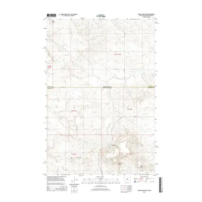
2015 Map of Table Mountain
USGS Topo · Published 2015About this map
Karinen sits at the heart of this high-plains landscape, where the state boundary between North Dakota and South Dakota intersects with the line between Bowman and Harding Counties. The terrain is defined by a series of prominent rises and drainage systems, most notably Table Mtn and Dead Horse Butte in the southern portion of the quadrangle. These landmarks, along with Long Grassy Butte to the north, serve as significant navigational points in an area characterized by a network of intermittent streams including Sevenmile Cr, Fivemile Cr, and Lone Tree Cr. Local roads like Cox Rd and Miller Pl weave through the section lines, connecting ranching landmarks such as Cooper Hill and the deep cuts of Gallager Draw. This topography reflects the cattle-country geography of the northern Great Plains, where every named draw and butte carries significance for land management and local history.
Find a feature on this map
29 named features on this map. Tap any name to fly to it.
Don’t see what you’re looking for? This feature index may not catch every label — zoom into the map to look around manually.
Map Details
Editions of this 2015 Table Mountain Map
This is the sole edition of this map. No revisions or reprints were ever made.
Other maps of this area

1935 · Buffalo
USGS Topo · 1:125,000

1953 · Dickinson
USGS Topo · 1:250,000

1954 · Lemmon
USGS Topo · 1:250,000

1957 · Dickinson
USGS Topo · 1:250,000

1957 · Lemmon
USGS Topo · 1:250,000

1969 · Ladner NE
USGS Topo · 1:24,000

1969 · Table Mountain
USGS Topo · 1:24,000

1969 · Ladner
USGS Topo · 1:24,000

1969 · Ladner SE
USGS Topo · 1:24,000

1973 · Camel Butte
USGS Topo · 1:24,000