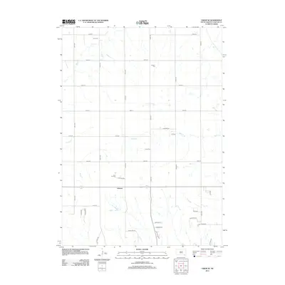
2012 Map of Tabor NE
USGS Topo · Published 2012About this map
Lakeport serves as a central hub for this rural Yankton County landscape, where agriculture and small communities define the prairie character. The map reveals a deeply rooted local history through its preservation of family and cultural burial sites, including Polish Cem, Nikodym Cem, and Nedved Cem. The terrain is etched by the meandering courses of Beaver Cr, Charley Cr, and Marne Cr, which drain the surrounding fields into the larger regional watershed. A precise grid of section-line roads, such as 303rd St and 430th Ave, organizes the territory, while specialized routes like Lake Port Rd and Boy Scout Rd point to the area's community and recreational significance. This 2012 survey provides a clear look at the enduring rural layout of South Dakota shortly after the turn of the 21st century.
Find a feature on this map
36 named features on this map. Tap any name to fly to it.
Don’t see what you’re looking for? This feature index may not catch every label — zoom into the map to look around manually.
Map Details
Editions of this 2012 Tabor NE Map
This is the sole edition of this map. No revisions or reprints were ever made.
Other maps of this area

1898 · Olivet
USGS Topo · 1:125,000

1898 · Parker
USGS Topo · 1:125,000

1955 · Sioux City
USGS Topo · 1:250,000

1955 · Sioux Falls
USGS Topo · 1:250,000

1957 · Jamesville
USGS Topo · 1:24,000

1958 · Sioux City
USGS Topo · 1:250,000

1958 · Sioux Falls
USGS Topo · 1:250,000

1959 · Sioux City
USGS Topo · 1:250,000

1968 · Tabor SE
USGS Topo · 1:24,000

1968 · Gavins Point Dam
USGS Topo · 1:24,000