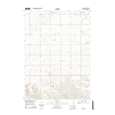
2015 Map of Tabor NE
USGS Topo · Published 2015About this map
Lakeport and Utica serve as the primary anchors in this rural Yankton County landscape, where the land is organized by a strict grid of township lines and section roads. The geography is defined by a series of south-flowing waterways, including Beaver Cr, Marne Cr, and Charley Cr, which carve gentle drainage patterns into the agricultural plains. For genealogists and local historians, the map is remarkably dense with specific heritage sites, documenting several family and community burial grounds such as Polish Cem, Nikodym Cem, Nedved Cem, and Elm Grove Cem. This concentration of namesake cemeteries reflects the deep-rooted settlement patterns and ethnic enclaves that established the social fabric of southeastern South Dakota during the late nineteenth and early twentieth centuries.
Find a feature on this map
33 named features on this map. Tap any name to fly to it.
Don’t see what you’re looking for? This feature index may not catch every label — zoom into the map to look around manually.
Map Details
Editions of this 2015 Tabor NE Map
This is the sole edition of this map. No revisions or reprints were ever made.
Other maps of this area

1898 · Olivet
USGS Topo · 1:125,000

1898 · Parker
USGS Topo · 1:125,000

1955 · Sioux City
USGS Topo · 1:250,000

1955 · Sioux Falls
USGS Topo · 1:250,000

1957 · Jamesville
USGS Topo · 1:24,000

1958 · Sioux City
USGS Topo · 1:250,000

1958 · Sioux Falls
USGS Topo · 1:250,000

1959 · Sioux City
USGS Topo · 1:250,000

1968 · Tabor SE
USGS Topo · 1:24,000

1968 · Gavins Point Dam
USGS Topo · 1:24,000