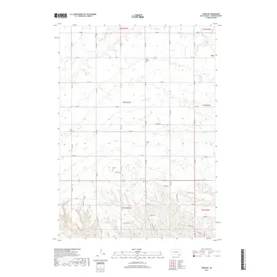
2017 Map of Tabor NE
USGS Topo · Published 2017About this map
Utica sits at the northeastern corner of this Yankton County landscape, where the prairie is defined by a dense grid of section-line roads and the winding paths of Beaver Cr and Marne Cr. The region’s cultural history is preserved in its numerous cemeteries, which reflect the heritage of the early settlers. From the Polish Cem in the north to the Cesko Narodni Hrbitov further south, these sites indicate the diverse European immigrant communities that established roots here. The drainage patterns of Charley Cr and its tributaries carve across the township blocks, leading toward the more developed residential corridors near the southern boundary. Local transit is managed through a numbered grid of avenues and streets, including Lake Port Rd and State St, while smaller developments like Valley View Rd and Sundance Rdg show more modern residential expansion within the rural sections.
Find a feature on this map
43 named features on this map. Tap any name to fly to it.
Don’t see what you’re looking for? This feature index may not catch every label — zoom into the map to look around manually.
Map Details
Editions of this 2017 Tabor NE Map
This is the sole edition of this map. No revisions or reprints were ever made.
Other maps of this area

1898 · Olivet
USGS Topo · 1:125,000

1898 · Parker
USGS Topo · 1:125,000

1955 · Sioux City
USGS Topo · 1:250,000

1955 · Sioux Falls
USGS Topo · 1:250,000

1957 · Jamesville
USGS Topo · 1:24,000

1958 · Sioux City
USGS Topo · 1:250,000

1958 · Sioux Falls
USGS Topo · 1:250,000

1959 · Sioux City
USGS Topo · 1:250,000

1968 · Tabor SE
USGS Topo · 1:24,000

1968 · Gavins Point Dam
USGS Topo · 1:24,000