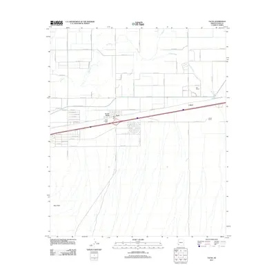
2011 Map of Tacna
USGS Topo · Published 2011About this map
Tacna serves as the central hub of activity on this Arizona landscape, defined by its position between the winding Gila River to the north and the southern desert terrain marked by Baker Peaks. The settlement pattern reflects a transit-oriented history, with the town core hosting the Tacna Post Office alongside infrastructure like the Tacna Landing Strip. Moving east, the community of Colfred sits along the transit corridor near the Colfred Airport, illustrating the reliance on local aviation in this arid environment. The landscape is characterized by natural drainage features including the Mohawk Wash, which cuts across the plains toward the river. Residential development in the area is visible through organized street grids such as Citrus Cir and specialized corridors like Frontage Rd, contrasting with the surrounding open terrain and rural routes like Dobson Rd.
Find a feature on this map
58 named features on this map. Tap any name to fly to it.
Don’t see what you’re looking for? This feature index may not catch every label — zoom into the map to look around manually.
Map Details
Editions of this 2011 Tacna Map
This is the sole edition of this map. No revisions or reprints were ever made.
Other maps of this area

1926 · Wellton
USGS Topo · 1:62,500

1926 · Mohawk
USGS Topo · 1:62,500

1928 · Mohawk
USGS Topo · 1:62,500

1928 · Norton
USGS Topo · 1:62,500

1929 · Wellton
USGS Topo · 1:62,500

1929 · Norton
USGS Topo · 1:62,500

1942 · Yuma
USGS Topo · 1:250,000

1953 · Ajo
USGS Topo · 1:250,000

1954 · El Centro
USGS Topo · 1:250,000

1955 · El Centro
USGS Topo · 1:250,000