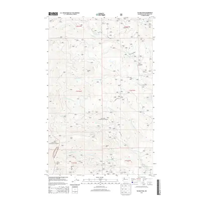
2014 Map of Tacoma Peak
USGS Topo · Published 2014About this map
Tacoma Peak and the surrounding high-elevation terrain of northeastern Washington dominate this 2014 survey. This portion of the Selkirk Mountains is shared by the Kanisku National Forest and Colville National Forest, featuring a complex network of drainage basins. Numerous streams, including Tacoma Creek and Calispell Peak Creek, have carved deep valleys between prominent landmarks such as Boulder Mountain and Fourth of July Mountain. Toward the southeast corner, the terrain softens slightly around Conger Lake and Conger Pond. The map reveals a high concentration of forest service and logging roads, such as Trimble Creek Road and Calispell Peak Road, which navigate the steep gradients and ridges, providing essential access to these remote timberlands and recreational areas.
Find a feature on this map
27 named features on this map. Tap any name to fly to it.
Don’t see what you’re looking for? This feature index may not catch every label — zoom into the map to look around manually.
Map Details
Editions of this 2014 Tacoma Peak Map
This is the sole edition of this map. No revisions or reprints were ever made.
Other maps of this area

1927 · Chewelah
USGS Topo · 1:125,000

1929 · Colville
USGS Topo · 1:125,000

1930 · Chewelah
USGS Topo · 1:125,000

1933 · Colville
USGS Topo · 1:125,000

1934 · Metaline
USGS Topo · 1:125,000

1936 · Newport
USGS Topo · 1:96,000

1942 · Metaline
USGS Topo · 1:125,000

1942 · Newport
USGS Topo · 1:125,000

1958 · Sandpoint
USGS Topo · 1:250,000

1963 · Sandpoint
USGS Topo · 1:250,000