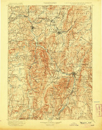
1900 Map of Taconic
USGS Topo · Published 1905About this map
Hoosac Tunnel serves as a critical engineering anchor in the eastern portion of this late-nineteenth-century survey, where the borders of New York, Massachusetts, and Vermont converge. The landscape is defined by the narrow valleys of the Hoosic River and Walloomsac River, which channeled the industrial and rail development of the era. Significant manufacturing hubs and transit points are evident at Hoosick Falls, North Bennington, and North Adams, where the Fitchburg R.R. and Bennington & Rutland R.R. meet. High elevations like Mt. Anthony and Berlin Mt. separate these bustling valley settlements from the smaller agricultural hamlets of Petersburg and Shaftsbury Center. The map captures an era of peak rail connectivity and local industry, documenting specialized locales such as Paper Mill Village and numerous small lakes including Big Pond and Sucker Pond.
Find a feature on this map
223 named features on this map. Tap any name to fly to it.
Don’t see what you’re looking for? This feature index may not catch every label — zoom into the map to look around manually.
Map Details
Editions of this 1900 Taconic Map
4 editions found

Other maps of this area

1886 · Greylock
USGS Topo · 1:62,500

1886 · Hawley
USGS Topo · 1:62,500

1886 · Chesterfield
USGS Topo · 1:62,500

1886 · Becket
USGS Topo · 1:62,500

1888 · Becket
USGS Topo · 1:62,500

1888 · Berlin
USGS Topo · 1:62,500

1888 · Chesterfield
USGS Topo · 1:62,500

1888 · Pittsfield
USGS Topo · 1:62,500

1889 · Wilmington
USGS Topo · 1:62,500

1890 · Hawley
USGS Topo · 1:62,500